Scientific and general literary references pertaining to Susac are limited. The island was not specifically mentioned by either Greek or Roman historical geographers. Susac is mentioned in early historic references, but only as a periphery island of minimal interest. For example, Susac was featured on Medieval sailing charts and apparently functioned as a useful navigational aid for sailors en route to other maritime destinations (Kozlicic 1997). The waters near this obscure island were often disputed as commercial Venetian fishing fleets and local islanders competed for access to the rich fishing grounds (Novak 1952). Most later historical descriptions of the Susac tend to be extremely brief (e.g. Burton 1879) and provide nothing more than general and often vague geographic details.
Location
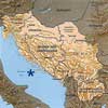
Susac lies off the central Dalmatian Coast of Croatia and is situated within the southern island group along with Korcula, Lastovo, and Mjlet (figure 1).
The "line-of-sight" connections to the nearby islands, as noted elsewhere in the Adriactic (e.g. Forenbaher et al. 1994), also apply to Susac. On most days, the islands of Vis, Hvar, Korcula, and Lastovo are visible to the north and west. The remote island of Palagruza is usually visible to the south west and with the right atmospheric conditions, the faint coastline of Italy's Promontorio del Gargano can be seen on the far western horizon. Limited sections of the southern peaks of the Dinaric Alps are just visible on the Croatian mainland, although the near-shore islands obscure most of the view. Visibility categories recently applied to islands in the Mediterranean Basin can be assigned to Susac (Patton 1996). Following the model set out by Patton, Susac would best qualify as a "B" category island (i.e. can be reached without sailing out of the sight of land) (see Bass 1998).
Present inhabitants
Operational personnel occupy the lighthouse situated on the southern promontory, and a sheep and goat herder maintains a farmstead near the Sv. Mihovil church. One footpath roughly extends across the island, but the main thoroughfare is between the lighthouse and the farmstead. Susac rarely has more than five residents at any given time, although this can fluctuate as family members visit or lighthouse caretakers rotate their duties. The extensive agricultural terracing found on the larger islands and mainland is absent, although a few drystone walls for historical land divisions and terraces for drying fishing nets are present (Novak 1952).
Geology, relief, vegetation
Susac's landmass covers roughly 4.6 sq. km, with a width varying between 0.3 and 1.8 km. The highest elevation is Susac vrh, situated at 239 meters above sea level. Tectonically, the island is in the south Adriatic unit of a palaeo-orogenic complex, now comprised of subsiding ridges. The northern section of the island is an Upper Jurassic formation, while the southern promontory, with its connecting lowland saddle, is Lower Cretaceous. The soils vary in quality and type, and there is abundant supply of limestone breccia. A freshwater lokva, or seasonal pond, is found above of the drainage leading to the bay at Dol. The submarine topography rapidly drops off from the island's coastline, with the greatest near-shore depths off the northern coast. In certain locations, the depths plunge beyond the 90-meter mark less than one hundred meters from the island's current shoreline.
Strictly for descriptive purposes, Susac can be divided into three topographic areas: the northern hills, the lowland saddle, and the southern promontory (figure 2).
The northern hills have a fairly gradual relief. Dense vegetation covers nearly all of the hilltops and surrounding slopes and land survey in this area proved to be quite difficult. The lowland saddle stretches from the Sv. Mihovil church to the southern slopes of the bay at Uvala Duga. Most of the eastern shoreline, from Dol to Uvala Duga, has a gradual relief. The shore zone in some areas is cobble and gravel, but most of the inter-tidal zones are comprised of jagged, wave-cut limestone. This is in direct contrast with the western shoreline of the lowland saddle, which consists mainly of sheer cliffs and steeply sloped escarpment. The peak on the southern promontory rises to ca. 80 masl. The island's lighthouse, built in the nineteenth century during the period of Austro-Hungarian control, is situated at the top of the promontory. The cliffs surrounding the promontory are sheer and plunge directly into the sea.
The vegetation on Susac consists primarily of pistacia (Pistacia lentiscus), juniper (Juniperus phoenicia), thistle (Carthamus sp.), asparagus (Asparagus acutifolius), and rosemary (Rosmarinus officinalis), but more than twenty five floral species have been collected by the KARG for identification. Wild olive trees and the makija scrub brush also thrive on the central and northern sections of the island. Terrestrial faunas include numerous species of birds, lizards, mice, and rats. Freshwater for human consumption does not exist, so the inhabitants collect rainwater in cisterns cut out of the limestone.

